

Simcoe Street Rapid Transit Visioning Study
As one of the fastest growing municipalities, Durham Region’s population is expected to double by 2041. To support our continued growth and prosperity, the Region will need a strong, integrated transit system that will continue to add capacity for the safe, efficient, and reliable movement of people and goods, sustainably and effectively.
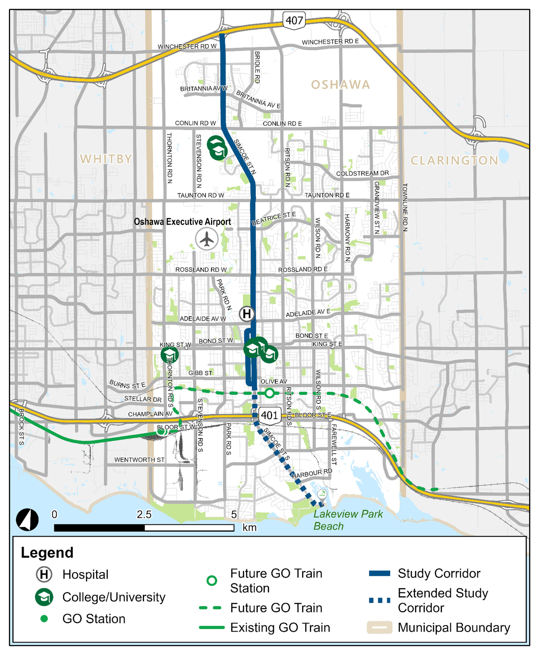
The Region of Durham’s 2017 Transportation Master Plan and Metrolinx’s 2041 Regional Transportation Plan both identify the need for a rapid transit corridor along Simcoe Street between Highway 407 and the proposed Ritson GO Transit station in the City of Oshawa.
Simcoe Street Rapid Transit Visioning Study
The Simcoe Street Rapid Transit Visioning Study is an opportunity to learn how to improve mobility and quality of life for existing residents while preparing the corridor to attract and support future growth.
The Study will look at ways to assess rapid transit investments based on evolving best practices in the areas of diversity, equity and including the economic benefit of concepts centred around rapid transit and transit-oriented communities.
The Region of Durham’s Rapid Transit Office is initiating the Simcoe Street Rapid Transit Visioning Study to identify a preferred option for rapid transit for this corridor. The Study will assess travel demand and future growth from a high-level perspective and investigate community objectives and expectations for the Simcoe Street corridor.
Project objective
The primary objective of the project is to develop a concept plan, including preferred stations and connections, and a supportive service strategy for the Simcoe Street rapid transit corridor. The Study will also consider future transit planning initiatives by Metrolinx, transit agencies and regional and municipal authorities.
Study Area
The Study Area will be focused primarily along Simcoe Street between Highway 407 and Lakeview Park Beach in the City of Oshawa.
Join the conversation
It’s time to have your say about our future!
Visit the project webpage at YourVoice.durham.ca/simcoe-street-rapid-transit to:
- Learn more about the project.
- Sign up for our mailing list.
- Leave a comment on the interactive map.
- Stay up to date on key milestones and opportunities to get involved.
Current engagement opportunities
Stay tuned for more information!
Contact us:
Email: Simcoe@durham.ca
Telephone: 905-668-7711 extension 2198
Sign up to our Newsletter
Stay up to date on the Region's activities, events, programs and operations by subscribing to our eNewsletters.