Close Alert Banner
Close Old Browser Notification
Browser Compatibility Notification
It appears you are trying to access this site using an outdated browser. As a result, parts of the site may not function properly for you. We recommend updating your browser to its most recent version at your earliest convenience.
Skip to Content
Region of Durham Logo
Contact Us
Engage
  • Living Here
    • 311 – Connecting you to our services
    • A to Z Services
    • Accessibility
    • Age-Friendly Durham
    • Animal Services and Control
    • Climate, Energy and Resilience
    • Conservation Authorities
    • Counselling
    • Crime Prevention and Public Safety
    • Early Learning and Child Care
    • Education and Schools
    • Emergency Preparedness
    • Emergency Services
    • Emergency Social Services
    • Food Banks
    • Housing and Homelessness
    • Libraries
    • Living with Low-Income
    • Long Term Care and Adult Day Programs
    • View More...
    View our Garbage and Recycling page

    Garbage and Recycling

    View our My Property page

    My Property

    View our Roads and Traffic page

    Roads and Traffic

  • Discovering Durham
    • About Durham Region
    • Arts and Culture
    • Bike Month
    • Cycling and Walking
    • E-mobility
    • Local Food and Farmers' Markets
    • Maps
    • New to Durham Region
    • Parks, Trails and Conservation Areas
    • Spectator Sports
    • Sport Tourism
    • Sports and Recreation
    • Tourism
    • Tourism Festival and Events Calendar
    • Transportation and Transit
    View our Tourism page

    Tourism

    View our Tourism Festival and Events calendar

    Tourism Festival and Events Calendar

    View our Transportation and Transit page

    Transportation and Transit

  • Doing Business
    • Applications, Licences and Permits
    • As-Built Drawing Request
    • Bid Opportunities
    • Business Directory
    • Business Count
    • Community Social Investment Framework
    • Construction and Your Business
    • Construction Liens
    • Design and Construction Specifications
    • Economic Development
    • Events
    • Garbage and Recycling Collection on Private Property
    • Housing
    • Municipal Consent
    • Operating a Child Care Centre
    • Planning and Development
    • Public Health Inspections for Businesses
    • Purchasing
    • Project Reports, Studies and Plans
    View our Agriculture page

    Agriculture

    View our Business Directory page

    Business Directory

    View our Purchasing page

    Purchasing

  • Health and Wellness
    • Alcohol, Cannabis, Drugs and Smoking
    • Babies and Toddlers
    • Child Health and School-Age Children
    • Clinics and Classes Calendar
    • COVID-19 Update
    • Domestic Violence
    • Dental and Oral Health
    • Environment and Your Health
    • Health Care Professionals
    • Health Check-Up, Performance Reports and Health Plans
    • Health Information Services
    • Healthy Living
    • Illness, Infection and Disease
    • Immunizations and Vaccines
    • Injury Prevention and Safety
    • Mental Health
    • MPOX
    • Pregnancy
    • Public Health Inspections and Investigations
    • View More...
    Launch the Durham Region COVID-19 Data Tracker

    COVID-19 Data Tracker

    View our Health Care Professionals page

    Health Care Professionals

    View our Report Immunizations Online page

    Report Immunizations Online

  • Regional Government
    • A to Z Services
    • Access to Information
    • Accountability and Transparency
    • Awards
    • Bill 23
    • Budget and Financial
    • By-Laws
    • Careers and Volunteering
    • CityStudio Durham
    • Community Engagement
    • Community Safety and Well-Being Plan
    • Contact Us
    • Court and Traffic Tickets (Provincial Offences)
    • COVID-19 Information and Resources
    • COVID-19 Recovery Framework and Action Plan
    • Departments
    • Diversity, Equity and Inclusion
    • Durham Region 101
    • Durham Region Strategic Plan
    • View More...
    View our Council page

    Council

    View our Open Data page

    Open Data

    View our Regional Services map

    Regional Services

I'd Like To...

Apply or Register For

  • Applications, Licences and Permits
  • Bidding Opportunities
  • Careers and Volunteering
  • Freedom of Information Request
  • Housing

Learn About

  • A to Z Services
  • Being New to Durham Region
  • Budget
  • By-Laws
  • Council
  • Durham Region Transit
  • Public Health Inspections

Report an Issue

  • By-Law Infraction
  • Downed Sign
  • Health Protection Complaint
  • Illegal Dumping
  • Missed Garbage or Recycling Pickup
View our Twitter Page View our Facebook Page View our YouTube Page view our LinkedIn page

Vehicles driving on road

Roads and Traffic

HomeDiscovering DurhamTransportation and TransitRoads and Traffic
Decrease text size Default text size Increase text size
Print this page
Share this page
  • Facebook
  • LinkedIn
  • Twitter
  • Email
  • Transportation and Transit
    • Accessible and Specialized Transit
    • Airports
    • Carpooling
    • Durham Region Transit
    • GO Transit
    • Roads and Traffic
    • Traffic Watch Map
    • VIA Transit and Rail
  • About Durham Region
    • Local Municipalities
    • Location and Getting Here
  • Arts and Culture
  • Bike Month
  • Cycling and Walking
  • E-mobility
  • Local Food and Farmers' Markets
  • Maps
  • New to Durham Region
  • Parks, Trails and Conservation Areas
  • Spectator Sports
  • Sport Tourism
  • Sports and Recreation
  • Tourism
  • Tourism Festival and Events Calendar

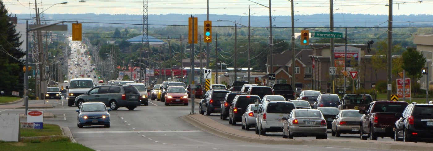
The Regional Municipality of Durham's Works Department plans, designs, builds and maintains the Regional Road Network. This includes bridges, storm sewers, traffic signals, signs, pavements marking and guiderails on Regional roads.

We also work with storm sewers, traffic signals, signs and guiderails.

View the roads we maintain

Road network planning

We plan the road network according to the Transportation Master Plan. This plan forecasts our transportation needs over many years. It includes your input and other Regional strategies for cycling, carpooling and transit. 

Transportation Master Plan

Road construction projects

Road construction projects are undertaken to address road conditions and to expand the capacity of the Regional road network. These projects appear on the Public Works Projects Map.

Public Works Projects Map

Road safety review and planning

Road safety review and planning is another important part of the work we do. We want to make sure our transportation system is safe.

Road maintenance

Maintenance of the road network includes:

  • Maintaining the road, such as repairing potholes and cracks, line painting, and other construction projects.
  • Responding to winter conditions.
  • Maintaining road sides and ditches.
  • Installing and maintaining traffic signals and Accessible Pedestrian Crossings.

Planned Road Repairs on Regional Roads 

Stay up-to-date on all the latest Road Construction information

  • Subscribe to the durham.ca Newsroom's Public Service Announcements (PSAs), News Releases and Durham Works updates at durham.ca/subscribe
  • Follow @RegionOfDurham on Facebook and Twitter
  • Check out the latest details of Works Projects at durham.ca/WorksProjects
Town of Ajax
Road Repairs
RoadRestrictions requiredLocationStart DateTentative End DatePurposeProject LinksStatus
Lake Ridge Road
(Regional Road 23)
Lane restrictions

From north side of Taunton Road

to south side of Highway 7 

May 6  June 4  
To safely complete routing and sealing of roadway asphalt cracks.
   Planned


Township of Brock 
Check back for project updates. 
Municipality of Clarington 
 
Road Repairs
RoadRestrictions requiredLocationStart DateTentative End DatePurposeProject LinksStatus
Regional Road 57 Lane restrictions

From north side of Concession 4 to 0.13 km south of Taunton Road 

May 10  June 4  
To safely complete routing and sealing of roadway asphalt cracks.
   Planned
City of Oshawa 
 
Road Repairs
RoadRestrictions requiredLocationStart DateTentative End DatePurposeProject LinksStatus
Harmony Road (Regional Road 33)  Lane restrictions

From 0.5 km north of Conlin Road

to south of Winchester Road 

May 10  June 4  
To safely complete routing and sealing of roadway asphalt cracks.
   Planned
Simcoe Street (Regional Road 2)  Lane restrictions

From north of Highway 407

to south of Steepleview Court

May 10 June 4 To safely complete routing and sealing of roadway asphalt cracks.   Planned
Simcoe Street (Regional Road 2)  Lane restrictions

0.1 km South of Howden Road East

to 1.52 km north of Regional Road 5 

May 10 June 4 To safely complete routing and sealing of roadway asphalt cracks.   Planned
Myrtle Road (Regional Road 5) Lane restrictions

0.2 km east of Highway 12/7 to Simcoe Street      

May 10  June 4 To safely complete routing and sealing of roadway asphalt cracks.    Planned
 City of Pickering
 
Road Repairs
RoadRestrictions requiredLocationStart DateTentative End DatePurposeProject LinksStatus
Brock Road (Regional Road 1) Lane restrictions

From 1.8 km north of Regional Road 5

to Uxbridge Pickering Townline

May 10  June 4  
To safely complete routing and sealing of roadway asphalt cracks.
   Planned
 Township of Scugog 
 
Road Repairs
RoadRestrictions requiredLocationStart DateTentative End DatePurposeProject LinksStatus
Regional Road 57

Lane restrictions


From 50m north of Mountjoy Road

to Shirley Road 

May 10 June 4  
To safely complete routing and sealing of roadway asphalt cracks.
   Planned
Shirley Road (Regional Road 19)

Lane restrictions

From Russell Road

to 1km east on Shirley Road 

May 10 June 4 To safely complete routing and sealing of roadway asphalt cracks.   Planned
Simcoe Street (Regional Road 2)

Lane restrictions

From Scugog Line 3

to 0.8km north of Scugog Line 3

May 10 June 4 To safely complete routing and sealing of roadway asphalt cracks.   Planned
Simcoe Street (Regional Road 2)

Lane restrictions

From 0.2 km south of Old Simcoe Road

to 0.2 km north of Old Simcoe Rd    

May 10 June 4 To safely complete routing and sealing of roadway asphalt cracks.   Planned
Simcoe Street (Regional Road 2)

Lane restrictions

From River Street (Seagrave)

to north of Regional Road 6  

May 10 June 4 To safely complete routing and sealing of roadway asphalt cracks.   Planned


 Township of Uxbridge 
 Check back for project updates. 
 Town of Whitby
 
Planned Road Repairs
RoadRestrictions requiredLocationStart DateTentative End DatePurposeProject LinksStatus
Myrtle Road (Regional Road 5) Lane restrictions

0.2 km east of Highway 12/7

to Simcoe Street

May 10  June 4   
To safely complete routing and sealing of roadway asphalt cracks.
   Planned
Myrtle Road (Regional Road 5) Lane restrictions

From 50 m west of Highway 12/7 to 0.5 km east of Ashburn Road       

May 10 June 4
To safely complete routing and sealing of roadway asphalt cracks.
  Planned
Lake Ridge Road (Regional Road 23)  Lane restrictions

From north side of Taunton Road to south side of Highway 7 

May 10 June 4
To safely complete routing and sealing of roadway asphalt cracks.
  Planned


Road, filming and banner permits

Road, filming and banner permits are available for events, oversized loads and other special activities on roads.

Report an issue

If you see an issue related to a Regional road, storm sewer, traffic signal or sign, you can report it to your local Region of Durham Works Department depot.

For after-hours emergencies, please call: 905-576-9991 or 1-800-372-1104.

Receive email updates

Contact Us

Region of Durham logo

Living HereDiscovering DurhamDoing BusinessHealth and WellnessRegional Government

© 2023 Durham Region, 605 Rossland Road East, Whitby, Ontario L1N 6A3, Canada, Telephone (within regional limits): 311, Telephone: 905-668-7711, Toll-Free: 1-800-372-1102

HomeTerms of Use and Privacy StatementAccessibilityAccess to InformationCareersA to Z ServicesContact Us
By GHD Digital