Close Alert Banner
Close Old Browser Notification
Browser Compatibility Notification
It appears you are trying to access this site using an outdated browser. As a result, parts of the site may not function properly for you. We recommend updating your browser to its most recent version at your earliest convenience.
Skip to Content
Region of Durham Logo
Contact Us
Engage
  • Living Here
    • 211 – Connect with local community services
    • 311 – Connecting you to our services
    • A to Z Services
    • Accessibility
    • Age-Friendly Durham
    • Animal Services and Control
    • Child Care and Early Years
    • Climate Change and Energy
    • Conservation Authorities
    • Counselling
    • Crime Prevention and Public Safety
    • Durham Employment Services
    • Education and Schools
    • Emergency Preparedness
    • Emergency Services
    • Emergency Social Services
    • Garbage and Recycling
    • Housing and Homelessness
    • Libraries
    • View More...
    View our Garbage and Recycling page

    Garbage and Recycling

    View our My Property page

    My Property

    View our Roads and Traffic page

    Roads and Traffic

  • Discovering Durham
    • About Durham Region
    • Arts and Culture
    • Bike Month
    • Cycling and Walking
    • E-mobility
    • Local Food and Farmers' Markets
    • Maps
    • New to Durham Region
    • Parks, Trails and Conservation Areas
    • Spectator Sports
    • Sport Tourism
    • Sports and Recreation
    • Tourism
    • Tourism Festival and Events Calendar
    • Transportation and Transit
    View our Tourism page

    Tourism

    View our Tourism Festival and Events calendar

    Tourism Festival and Events Calendar

    View our Transportation and Transit page

    Transportation and Transit

  • Doing Business
    • Applications, Licences and Permits
    • As-Built Drawing Request
    • Bid Opportunities
    • Business Directory
    • Business Count
    • Community Social Investment Program
    • Construction and Your Business
    • Construction Liens
    • Design and Construction Specifications
    • Economic Development
    • Events
    • Funding Resources
    • Garbage and Recycling Collection on Private Property
    • Housing
    • Municipal Consent
    • Operating a Child Care Centre
    • Planning and Development
    • Public Health and Your Business
    • Purchasing
    View our Agriculture page

    Agriculture

    View our Business Directory page

    Business Directory

    View our Purchasing page

    Purchasing

  • Health and Wellness
    • Alcohol, Cannabis, Opioids, Tobacco and Vaping
    • Babies and Toddlers
    • Child Health and School-Age Children
    • Clinics and Classes Calendar
    • COVID-19
    • Domestic Violence
    • Dental and Oral Health
    • Environment and Your Health
    • Food and Eating
    • Health Care Professionals
    • Health Check-Up! Reports and Health Plans
    • Health Information Services
    • Healthy Living
    • Illness, Infection and Disease
    • Immunizations and Vaccines
    • Injury Prevention and Safety
    • Mental Health
    • Pregnancy
    • Public Health Inspections and Investigations
    • View More...
    View our Health Care Professionals page

    Health Care Professionals

    Launch the Durham Region Respiratory Virus Data Tracker

    Respiratory Virus Data Tracker

    Report Immunizations Online

    Report Immunizations Online

  • Regional Government
    • A to Z Services
    • Access to Information
    • Accountability and Transparency
    • Budget and Financial
    • By-Laws
    • Careers and Volunteering
    • CityStudio Durham
    • Community Engagement
    • Community Safety and Well-Being Plan
    • Contact Us
    • Court and Traffic Tickets (Provincial Offences)
    • Departments
    • Diversity, Equity and Inclusion
    • Durham Region 101
    • Durham Region Strategic Plan
    • Durham Works
    • Innovation
    • Local Municipalities
    • Municipal Elections
    • View More...
    View our Council page

    Council

    View our Open Data page

    Open Data

    View our Regional Services map

    Regional Services

I'd Like To...

Apply or Register For

  • Applications, Licences and Permits
  • Bidding Opportunities
  • Careers and Volunteering
  • Freedom of Information Request
  • Housing

Learn About

  • A to Z Services
  • Being New to Durham Region
  • Budget
  • By-Laws
  • Council
  • Durham Region Transit
  • Public Health Inspections

Report an Issue

  • By-Law Infraction
  • Downed Sign
  • Health Protection Complaint
  • Illegal Dumping
  • Missed Garbage or Recycling Pickup
View our X Page View our Facebook Page View our YouTube Page view our LinkedIn page

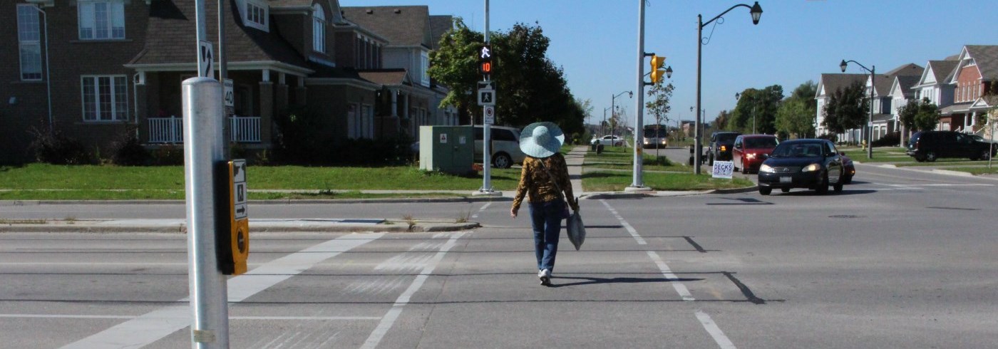
Woman crossing the road at a pedestrian crossing

Accessible Pedestrian Signals

HomeLiving HereAccessibilityAccessible Pedestrian Crossings
Decrease text size Default text size Increase text size
Print this page
Share this page
  • Facebook
  • LinkedIn
  • Twitter
  • Email
  • Accessibility
    • Accessible and Specialized Transit
    • Accessible (Modified) Housing
    • Accessible Pedestrian Crossings
    • Children with Special Concerns and Needs
  • 211 – Connect with local community services
  • 311 – Connecting you to our services
  • A to Z Services
  • Age-Friendly Durham
  • Animal Services and Control
    • Insects, Rodents and Bites
    • Rabies
  • Child Care and Early Years
    • Becoming an RECE
      • Child Development Practitioner (CDP) Apprenticeship
      • Early Childhood Education opportunities
      • Francophone Early Childhood Education programs and supports
      • Indigenous Early Childhood Education programs and supports
      • Other Early Childhood Education Programs
      • Pathways to Becoming a Registered Early Childhood Educator
    • Child Care Fee Help (Subsidy)
    • Children with Special Concerns and Needs
    • Data in the Early Years
    • EarlyON Child and Family Centres
    • Finding Quality Child Care
    • Operating a Child Care Centre
    • Regional Early Learning and Child Care Centres
    • Resources for Child Care Professionals
  • Climate Change and Energy
    • Adaptation and Resilience
    • Durham Climate Dashboard
    • Durham Greener Buildings
    • Durham Greener Homes
    • Energy
    • Greening Corporate Operations
    • Nuclear Generation in Durham
  • Conservation Authorities
  • Counselling
    • Adults with Developmental Disabilities - Services
    • Crisis Debriefing
    • Domestic Violence
    • Employee Assistance Program
  • Crime Prevention and Public Safety
    • Bullying
    • Domestic Violence
    • Elder Abuse
  • Durham Employment Services
  • Education and Schools
  • Emergency Preparedness
    • Business Preparedness
    • Nuclear Preparedness
    • Potassium Iodide (KI) Tablets
  • Emergency Services
    • Ambulance and Paramedics
    • Car Seat Safety and Booster Seats
    • Community Paramedicine
    • Designated Officers
    • Fire
    • Police
    • Public Access to Defibrillators
    • When to Call 911
  • Emergency Social Services
  • Garbage and Recycling
    • Apps (Mobile)
    • Bins - Broken or New
    • Collection Calendar
    • Durham York Energy Centre (Incinerator)
    • Food Waste Reduction and Backyard Composting
    • Garbage, Recycling, Green Bin and Other Collection
    • Green Bin Processing Using Anaerobic Digestion
    • Know Before You Throw
    • Long-Term Waste Management Plan 2022-2040
    • Reduce and Reuse
    • School Programs
      • School Programs - Community Groups
      • School Programs - Grade K to 8
      • School Programs - Grade 9 to 12
      • School Programs - Kids Zone
      • School Programs - Post Secondary
    • Special Events in Waste Management
    • Waste Management Facilities
    • Waste Management Videos
  • Housing and Homelessness
    • At Home in Durham
    • Housing Supports
      • Apply for Housing
        • Affordable Housing
        • Other Community Housing Providers
        • Seniors' Housing
      • Accessible (Modified) Housing
      • Community Housing
        • Durham Regional Local Housing Corporation
        • Rent-Geared-to-Income Housing (RGI)
          • Community Housing Properties
        • Resources for Community Housing Providers
      • Durham Access to Social Housing (DASH)
        • DASH Login
      • Renter's Toolkit
      • Regional Review Panel
    • New Housing Projects
    • Affordable Housing Development
    • Homeless Supports
      • Homeless Hubs and Street Outreach
      • Emergency Shelters for Victims of Violence
      • Shelters, Warming Centres and Cooling Locations
      • Homelessness Coordinated Access System
      • Homelessness Committees
  • Libraries
  • Living with Low-Income
    • Canada Learning Bond (RESP)
    • Child Care Fee Help (Subsidy)
    • Child Support
    • Community Health Centres
    • Credit and Debt Management
    • Dental and Oral Health
    • Disability Tax Credits and Benefits
    • Durham Access to Social Housing (DASH)
    • Durham Community Legal Clinic
    • File Your Taxes
    • Food Supports
    • Housing Outreach, Eviction Prevention and Utility and Rent Arrears Resources
    • Low and No-Cost Banking
    • Low-Cost Internet
    • Low Cost and Subsidized Recreation Programs
    • Mobile Benefits Hubs
    • Tenant Insurance
  • Long Term Care and Adult Day Programs
    • Adult Day Programs
    • Long-Term Care Homes
    • Long-Term Care Homes COVID-19 Update
    • Respite Care
    • Submit a Comment, Concern, or Complaint
    • Volunteer in one of our homes
    • Student Placements
  • My Property
    • Basement Flooding
    • By-Laws
    • Call Before You Dig
    • Garbage and Recycling
    • Land Development and Land Division
    • Private Wells
    • Permits
    • Property Taxes
    • Sewage and Septic Systems
    • Woodland By-Law
    • Water Billing
    • Water Efficiency
  • Ontario Works (Social Assistance)
    • Additional Benefits
    • Emergency Shelters
    • Food Supports
    • Income Employment and Homelessness Supports Division Programming
    • Housing, Shelters and Homelessness
    • How to Complete an Income Statement
    • MyBenefits
    • Ontario Works Payment Dates
    • Spousal and Child Support Assistance
    • Supports in the Community
  • Planning for Growth
  • Regional Cycling Plan 2021
  • Roads and Traffic
    • Automated Speed Enforcement
    • Cycling and Walking
    • Depot Locations
    • Durham Vision Zero
      • Crossrides
      • Line Painting
      • Pedestrian Crossovers
      • Radar Speed Signs
    • Parking
    • Red Light Cameras
    • Regional Road Maintenance
    • Regional Roads List
    • Regional Storm Sewers
    • Report an Issue
    • Road and Traffic Safety
    • Road Construction and Closures
    • Road, Filming and Banner Permits
    • Traffic Signals
    • Transportation and Transit
    • Traffic Watch Map
    • Weight Restriction Season
  • Source Water Protection
  • Transportation and Transit
  • Transportation Planning
  • Water and Sewer
    • About Water
      • York Durham Regional Environmental Lab
      • Fire Flow Testing
    • Backflow Prevention Program
    • Basement Flooding
    • Call Before You Dig
    • Connection Permits
    • Imagine a Day Without Water
    • Lead Service Replacement Program
    • Private Wells
    • Programs and Initiatives
    • Regional Storm Sewers
    • Report a Water Problem
    • Sewer Back Up
    • Wastewater and Sewers
      • Biosolids
    • Water Billing and Rates
    • Water Efficiency
    • Water Meters
    • Water Theft

Accessible pedestrian signals (APS) use audible tones and vibrations to assist pedestrians with a visual and/or hearing impairment by indicating when they have the right-of-way and which direction to cross at signalized intersections.

Using APS

To activate the APS, the pedestrian pushbutton must be pressed and held for at least three seconds.

Two audible tones are used to indicate the direction in which the pedestrian has the right-of-way.

  • A cuckoo sound indicates the walk symbol is on and can cross north or south.
  • A Canadian melody sound indicates the walk symbol is on and can cross east or west.

APS are also equipped with a continuous tone called a locator tone. This is emitted from the pushbuttons to help pedestrians find the pushbuttons. The APS and locator tones automatically adjust to ambient sound levels - volume increases during heavy traffic and decreases when traffic is lighter.

Pushbuttons have a raised arrow that points in the direction of travel and vibrates when the APS is activated

Requests for new APS

Requests for new APS can be made through the myDurham 311 Customer Portal.
Within regional boundaries: 311
Outside Regional Boundaries: 905-668-7711 or 1-800-372-1102
Email: Info@durham.ca

APS locations 


Ajax

  • Audley Rd. and Kerrison Dr.
  • Audley Rd. and Williamson Dr.
  • Bayly St. and Audley Rd.
  • Bayly St. and Harwood Ave.
  • Bayly St. and Kitney Dr.
  • Bayly St. and Monarch Ave.
  • Bayly St. and Shoal Point Rd.
  • Bayly St. and Westney Rd.
  • Church St. and Lincoln Alexander P.S.
  • Church St. and Lincoln St. / Randall Dr.
  • Church St. and Mill St.
  • Church St. and Rossland Rd.
  • Fairall St. and Dowty Rd.
  • Harwood Ave and Clements Rd.
  • Harwood Ave. and Biggs Dr.
  • Harwood Ave. and Emperor St.
  • Harwood Ave. and Hibbard Dr./Keensford Crt.
  • Harwood Ave. and Hunt St.
  • Harwood Ave. and Kings Crescent
  • Harwood Ave. and Notre Dame C.S.S.
  • Harwood Ave. and Station St. / Achilles Rd.
  • Highway 2 and Best Buy Ent. (W. of Harwood Ave.)
  • Highway 2 and Harwood Ave.
  • Highway 2 and Ritchie Ave. / Chapman Dr.
  • Highway 2 and Westney Plaza Entrance
  • Pickering Beach Rd. and Emperor St.
  • Rossland Rd. and Amazon Entrance
  • Rossland Rd. and Carter Bennett Dr./Pearce Dr.
  • Rossland Rd. and Harkins Dr. (IPS)
  • Rossland Rd. and Pickering Christian School
  • Rossland Rd. and Ravenscroft Rd.
  • Rossland Rd. and Riverside Dr./Seagrave Ln.
  • Salem Rd. and Ajax Operations Centre/Amazon Entrance
  • Salem Rd. and Blowers Cres.
  • Salem Rd. and Chambers Dr. / ManDrake St.
  • Salem Rd. and Lord Dr.
  • Taunton Rd. and Gillett Dr.
  • Taunton Rd. and Middlecote Dr.
  • Taunton Rd. and Ravenscroft Rd.
  • Taunton Rd. and Salem Rd.
  • Taunton Rd. and Warner Dr.
  • Taunton Rd. and Westney Rd.
  • Westney Rd. / Dreyer and Harwood Ave.
  • Westney Rd. and Atherton Ave/Curtis Gate
  • Westney Rd. and Coughlen St. / Sullivan Dr.
  • Westney Rd. and Delaney/Magill Dr.
  • Westney Rd. and Highway 2
  • Westney Rd. and Millington Cr.
  • Westney Rd. and Monarch Ave. / Rands Rd.
  • Westney Rd. and O'Brien Ct.
  • Westney Rd. and Rossland Rd.
  • Westney Rd. and Williamson Dr.

Clarington

  • Liberty St. and King St.
  • King St. and Scugog St.
  • Liberty St.  and Concession St.
  • Courtice Rd.  and Highway 2
  • Bowmanville Av. and Highway 2
  • Taunton Rd. and Trulls Rd. / Enfield Rd.
  • Bowmanville Av. and Baseline Rd.
  • Highway 2 and Clarington Blvd.
  • King St. and Roenigk Dr.
  • Clarington Blvd. and Stevens Rd.
  • King Ave. E. and Arthur St. / Brookhouse Dr.
  • Nash Rd. and Varcoe Rd.
  • Nash Rd. and Centerfield Dr.
  • Highway 2 and Maple Grove Rd.
  • Bowmanville Av. and Concession Rd. 3
  • Green Rd. and Stevens Rd.
  • Courtice Rd. and Nash Rd.
  • Bowmanville Ave. and Hartwell Ave.
  • Courtice Rd./Energy Dr. and Megawatt Dr./Courtice Shores Dr.
  • Energy Dr. and Highway 401 EB off/on ramps
  • Baseline Rd. and Spry Ave.
  • Bowmanville Ave. and Stevens Rd.
  • King St. and Mearns Ave.
  • King St. and Simpson Ave.
  • Longworth Ave. and Scugog St.
  • Nash Rd. and Trulls Rd.

Oshawa

  • Adelaide Ave. and Blackthorn St. (Eastdale CVI)
  • Athol St. and Mary St.
  • Bloor St. and Drew St. / Hwy 401 EB Ramp
  • Bloor St. and Park Rd. N.
  • Bloor St. and Thornton Rd.
  • Bloor St. and Wilson Rd.
  • Bond St. and Mary St.
  • Cedar St. and Phillip Murray Ave.
  • Centre St. and John St.
  • Centre St. and William St.
  • Champlain Ave. and Thornton Rd.
  • Coldstream Dr. and Clearbrook Dr.
  • Conlin Rd. and Founders Dr. (Durham College)
  • Conlin Rd. and Riverton St./Vern Bowen St.
  • Gibb St. and Grenfell Ave. (I.P.S.)
  • Gibb St. and Oshawa Centre Entrance
  • Grandview St. and Coldstream Dr.
  • Grandview St. and Greenhill Ave./Esterbrook Dr.
  • Harmony Rd. and Beatrice St.
  • Harmony Rd. and Coldstream Dr.
  • Harmony Rd. and Delpark Homes Centre S. (Legends Centre)
  • Harmony Rd. and Grand Ridge Ave.
  • Harmony Rd. and Greenhill Ave.
  • Harmony Rd. and King St.
  • Harmony Rd. and Walmart Ent. / Missom Gate
  • John St. and Midtown Mall
  • King St. and Bowmanville Mall
  • King St. and Eastlawn St.
  • King St. and Farewell Ave. (I.P.S.)
  • King St. and Gibbons St.
  • King St. and Mary St.
  • King St. and St. George
  • Park Rd. and Hillside Ave.
  • Phillip Murray Ave. and Park Rd.
  • Ritson Rd. and Coldstream Dr.
  • Ritson Rd. and Kedron Public School
  • Ritson Rd. and Ormond Dr.
  • Ritson Rd. and Pentland St.
  • Ritson Rd. and Ritson Road Public School
  • Ritson Rd. and William St.
  • Ritson Rd. and Woodmount Dr.
  • Rossland Rd. and Harmony Rd.
  • Rossland Rd. and Minto St.
  • Rossland Rd. and Wilson Rd.
  • Simcoe St. and Bloor St.
  • Simcoe St. and Britannia Ave.
  • Simcoe St. and Conlin Rd.
  • Simcoe St. and Dr. SJ Phillips School
  • Simcoe St. and Founders Gate
  • Simcoe St. and John St.
  • Simcoe St. and Northern Dancer
  • Simcoe St. and Olive Ave.
  • Simcoe St. and Robert St.
  • Simcoe St. and Winchester Rd.
  • Simcoe St. and Windfields Farm Dr. (temp)
  • Stellar Dr. and Thornton Rd.
  • Stevenson Rd. and Annapolis Ave.
  • Stevenson Rd. and Gibb St.
  • Stevenson Rd. and Oshawa Centre Entrance
  • Stevenson Rd. and Ridgeway Ave.
  • Taunton Rd. and Grandview St.
  • Taunton Rd. and Wilson Rd.
  • Thornton Rd. and Adelaide Ave.
  • Thornton Rd. and King St.
  • Townline Rd. and King St.
  • Wentworth St. and Cedar St.
  • Wilson Rd. and Athol St.
  • Wilson Rd. and Coldstream Dr.
  • Wilson Rd. and Shakespeare Ave.
  • Winchester Rd. and Harmony Rd.
  • Windfield Farms Dr. and Steeplechase St.

Pickering

  • Alexander Know Rd. and Brigadier Ave./Hollyberry Lane
  • Alexander Knox Rd. and Mulberry Lane
  • Altona Rd. and Pine Grove Ave.
  • Bayly St. and Liverpool Rd.
  • Brock Rd. and Alexander Knox Rd.
  • Brock Rd. and Collector Rd. (S of 407 EB off ramp)
  • Brock Rd. and Dersan St. / William Jackson Dr.
  • Brock Rd. and Finch Ave.
  • Brock Rd. and Highway 2
  • Brock Rd. and Hwy 401 EB Ramp
  • Brock Rd. and Hwy 401 WB Ramp
  • Brock Rd. and Major Oaks Rd./Usman Rd.
  • Brock Rd. and Pickering Parkway
  • Brock Rd. and Plummer St.
  • Brock Rd. and Third Concession Rd./Rossland Rd.
  • Brock Rd. and Zents Dr./Rex Heath Dr.
  • Church St. and Kellino St.
  • Clements Rd. and Squires Beach Rd.
  • Finch Ave. and Dixie Rd.
  • Finch Ave. and Rosebank Rd.
  • Glenanna Rd. and The Esplanade South
  • Highway 2 and Bainbridge Dr.
  • Highway 2 and Boyer Plaza / Delta Blvd.
  • Highway 2 and Glenanna Rd.
  • Highway 2 and Rougemount Dr.
  • Highway 2 and Valley Farm Rd.
  • Kellino St. and East St. (private signal for Durham Live)
  • Kingston Rd. and Steeple Hill
  • Liverpool Rd. and Bushmill St./Linwood St.
  • Liverpool Rd. and Finch Ave.
  • Liverpool Rd. and Highway 2
  • Peter Matthews Dr. and Alexander Knox Rd.
  • Pickering Parkway and Portland Crt. (I.P.S)
  • Taunton Rd. and Burkholder Dr.
  • Taunton Rd. and Peter Matthews Dr.
  • Valley Farm Rd. and The Esplanade S / Diefenbaker Ct.
  • Whites Rd. and Highway 2
  • Whites Rd. and Highway 7
  • Whites Rd. and Oklahoma Dr. / Granite Crt.
Scugog
  • Highway 7/12 and Cragg Rd.
  • Simcoe St. and Queen St.
  • Simcoe St. and Reach St. / Coulter St.
  • Simcoe St. and Van Edward Dr. (Port Perry)

Whitby

  • Anderson St. and Duggan Ave./Settler's Crt.
  • Anderson St. and Manning Rd.
  • Baldwin St. and Canary St.
  • Baldwin St. and GO Transit Carpool Access (south of 407 EB ramp)
  • Bayly St. / Victoria St. and Lake Ridge Rd.
  • Brock St. and 401 Eb Ramp / GO Station
  • Brock St. and Colborne St. (I.P.S.)
  • Brock St. and Dryden Blvd. / James Rowe Dr.
  • Brock St. and Joy Thompson Ave./Timber Mill Ave.
  • Brock St. and Mary St.
  • Brock St. and Whitburn St. / Woodlands Ave.
  • Cochrane St. and Dundas St.
  • Conlin Rd. and Garrard Rd.
  • Consumers Dr. and Brock St.
  • Consumers Dr. and Hwy 401 WB Ramp
  • Consumers Dr./Stellar Dr.  and Thickson Rd.
  • Dundas St. and Des Newman Blvd.
  • Dundas St. and Garrard Rd. / Kendalwood Rd.
  • Dundas St. and Hickory St.
  • Highway 2 and Halls Rd.
  • Highway 407 EB off ramp and Baldwin St./Highway 12
  • Highway 7/12 and Campbell St.
  • Manning Rd. and Hazelwood Dr.
  • Manning Rd. and Ribblesdale Dr.
  • Manning Rd.  / Starr Ave. and Brock St.
  • Mary St. and Hickory St.
  • Rossland Rd. and Anderson St.
  • Rossland Rd. and Brock St.
  • Rossland Rd. and Coronation Rd.
  • Rossland Rd. and Des Newman Blvd.
  • Rossland Rd. and Garden St.
  • Rossland Rd. and McQuay Blvd.
  • Rossland Rd. and Regional Headquarters
  • Stellar Dr. and Champlain Ave.
  • Taunton Rd. and Anderson St.
  • Taunton Rd. and Baldwin St. / Brock St.
  • Taunton Rd. and Baycliffe Dr.
  • Taunton Rd. and Cochrane St.
  • Taunton Rd. and Coronation Rd. (temp)
  • Taunton Rd. and Country Ln.
  • Taunton Rd. and Des Newman Blvd.
  • Taunton Rd. and Durham District School Board/Sinclair Secondary School
  • Taunton Rd. and Garrard Rd.
  • Taunton Rd. and McKinney Dr. / Riverwood St.
  • Taunton Rd. and Plaza Entrance (east of Garden St)
  • Taunton Rd. and Valleywood Dr.
  • Thickson Rd. and Burns St.
  • Thickson Rd. and Glengowan St.
  • Thickson Rd. and Nichol Ave.
  • Thickson Rd. and Summerside Ave./Gateway Ct.
  • Victoria St. and Brock St.
  • Victoria St. and Gordon St.
  • Victoria St. and South Blair St.
  • Winchester Rd. and Cachet Blvd.
  • Winchester Rd. and Memorial Park/Simcoe St (Brooklin)
  • Winchester Rd. and Thickson Rd.
Uxbridge
  • Brock St. (Hwy 47) and Herrema Blvd./Nelkydd Ln.
  • Highway 47 and Front St./Concession 3 (Goodwood)
  • Main St. and Colby Rd.
Receive email updates

Contact Us

Traffic Operations Centre
101 Consumers Dr. Whitby, ON L1N 6A3
T.: 905-666-8116
Toll Free:: 1-866-786-8116
F.: 905-666-8826
Email the Traffic Operations Centre


Region of Durham logo

Living HereDiscovering DurhamDoing BusinessHealth and WellnessRegional Government

© 2025 Durham Region, 605 Rossland Road East, Whitby, Ontario L1N 6A3, Canada, Telephone (within regional limits): 311, Telephone: 905-668-7711, Toll-Free: 1-800-372-1102

Terms of UsePrivacyCareersA to Z ServicesContact UsSitemap
By GHD Digital